Indoor Positioning
The problem
Global Navigation Satellite Systems (GNSS), including GPS, are widely used for outdoor navigation. Indoors, however, satellite signals are often too weak to provide a reliable position.
Indoor navigation also requires finer detail: users need to know which room or corridor they are in, rather than simply which building they are near.
My approach
My research uses existing WiFi networks and smartphones to estimate indoor locations.
The first step is to build a database of signal measurements collected at known positions throughout a building. During this survey, a WiFi-enabled device records the signals at each location and pairs them with a location label.
To estimate a user's position, the system compares their current signal measurements with this database and finds the closest match. This process is known as location fingerprinting.
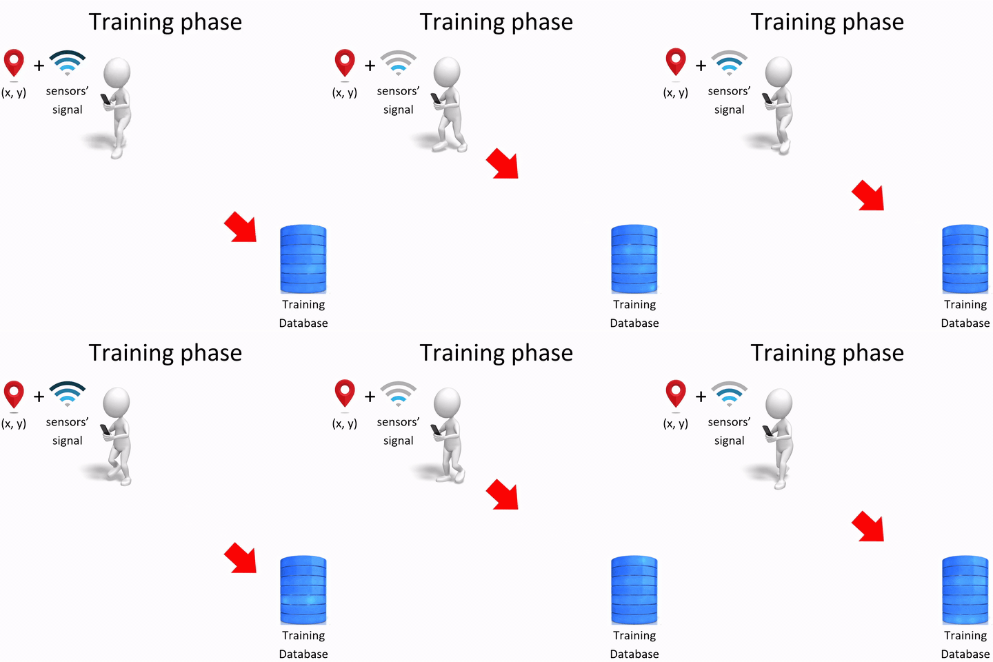
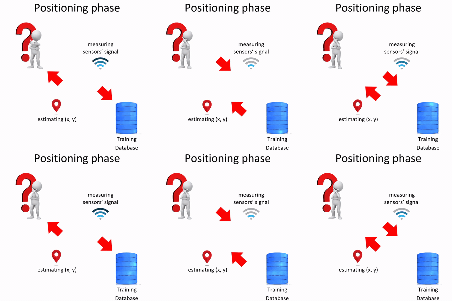
Indoor radio signals are difficult to predict. Building layouts affect how signals travel, while people moving through the space introduce further variation.
Our approach therefore estimates both a location and the uncertainty around it. At a 90% confidence level, the prediction region is designed to contain the true location in at least 90% of cases, under the method's statistical assumptions.
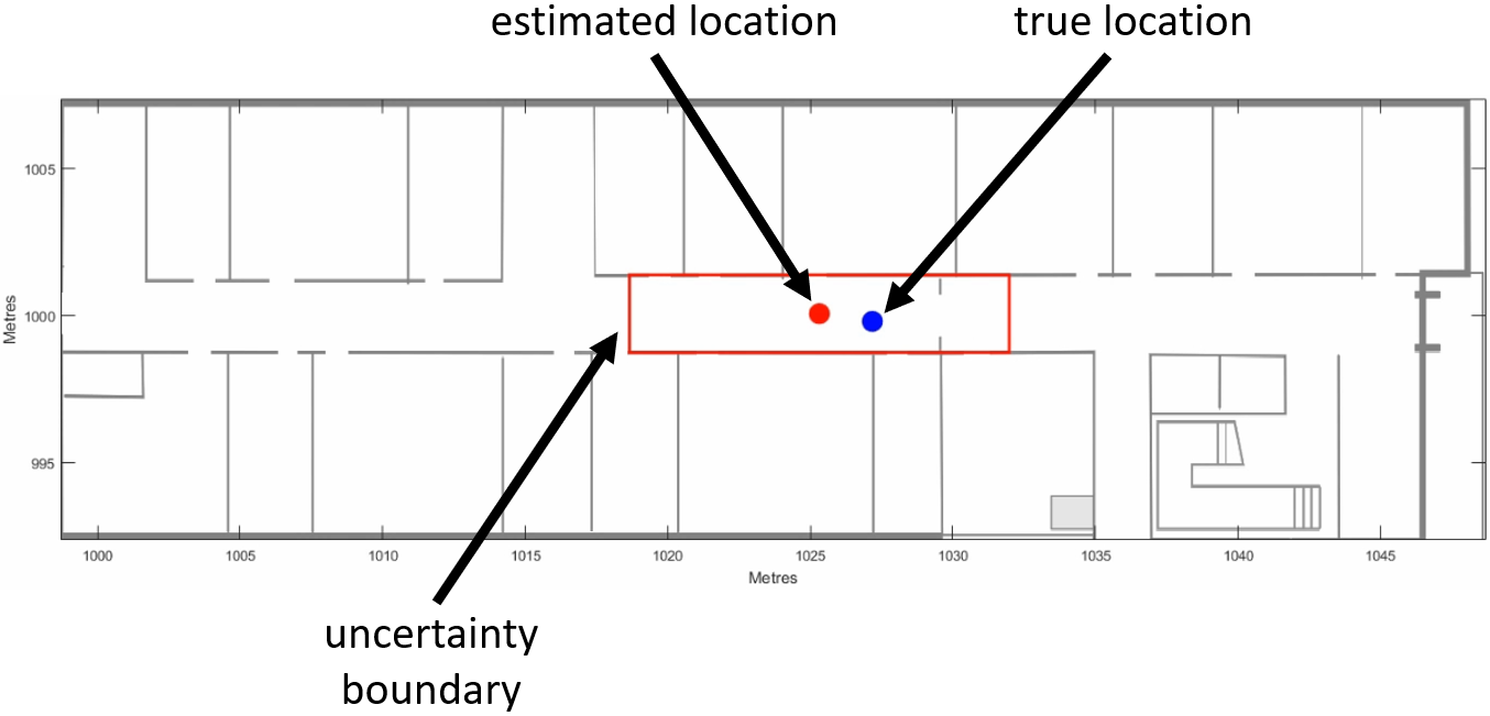
The video below compares two versions of our algorithm as they estimate a user's position in real time. The blue dot marks the true position, the red dot shows our estimate, and the black cross shows the Naive Bayes baseline. The upper plot visualises the probability distribution over possible locations.
In these experiments, both versions achieved positioning errors below two metres most of the time, slightly outperforming the baseline. The regression version produced slightly smaller prediction regions at the same confidence level.
The confidence level can also be adjusted to change the size of the prediction region. The following video illustrates this trade-off between confidence and precision.
Publications
For further details, see the publications below.1) Nguyen, Khuong An, and Zhiyuan Luo. "Selective mixture of Gaussians clustering for location fingerprinting." In Proceedings of the 11th International Conference on Mobile and Ubiquitous Systems: Computing, Networking and Services (Mobiquitous 2014), pp. 328-337. ICST (Institute for Computer Sciences, Social-Informatics and Telecommunications Engineering), 2014.
2) Nguyen, Khuong An, and Zhiyuan Luo. "Reliable indoor location prediction using conformal prediction." Annals of Mathematics and Artificial Intelligence 74, no. 1-2 (2015): 133-153.
3) Nguyen, Khuong An, and Zhiyuan Luo. "Dynamic route prediction with the magnetic field strength for indoor positioning." International Journal of Wireless and Mobile Computing 12, no. 1 (2017): 16-35.
4) Nguyen, Khuong, and Zhiyuan Luo. "Conformal prediction for indoor localisation with fingerprinting method." In IFIP International Conference on Artificial Intelligence Applications and Innovations, pp. 214-223. Springer, Berlin, Heidelberg, 2012.
5) Nguyen, Khuong An. "A performance guaranteed indoor positioning system using conformal prediction and the WiFi signal strength." Journal of Information and Telecommunication 1, no. 1 (2017): 41-65.