Tracking Journeys on the London Underground
The problem
Knowing where a train is between stations can be difficult when GPS and other positioning signals are unavailable. This study explored how passengers could estimate their progress through London Underground tunnels using only a smartphone.
Station-based information, such as Oyster card entry and exit records or detections from platform WiFi access points, can identify parts of a journey. It does not, however, continuously locate a passenger between stations.
My approach
Our approach combines smartphone accelerometer readings with a database of recorded train movements and tunnel characteristics to estimate a passenger's location in real time. Filters reduce noise caused by the passenger's own movements, helping reveal the motion of the train.
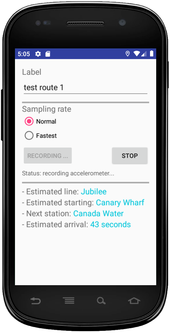
The system runs entirely within a smartphone app, which records sensor readings, stores the reference database and estimates the route.
It requires no additional infrastructure on the Underground network and no internet connection. Sensor readings are stored temporarily on the phone for matching, then deleted once a match is found or the app is closed.
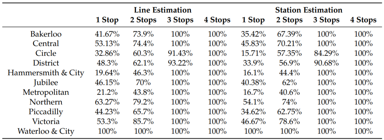
In our evaluation across all 11 London Underground lines, the system identified the correct line and station in every tested case after at least four consecutive stops. Using PCA-based position estimation, it achieved a positioning error within 18 metres with 90% probability in the study.
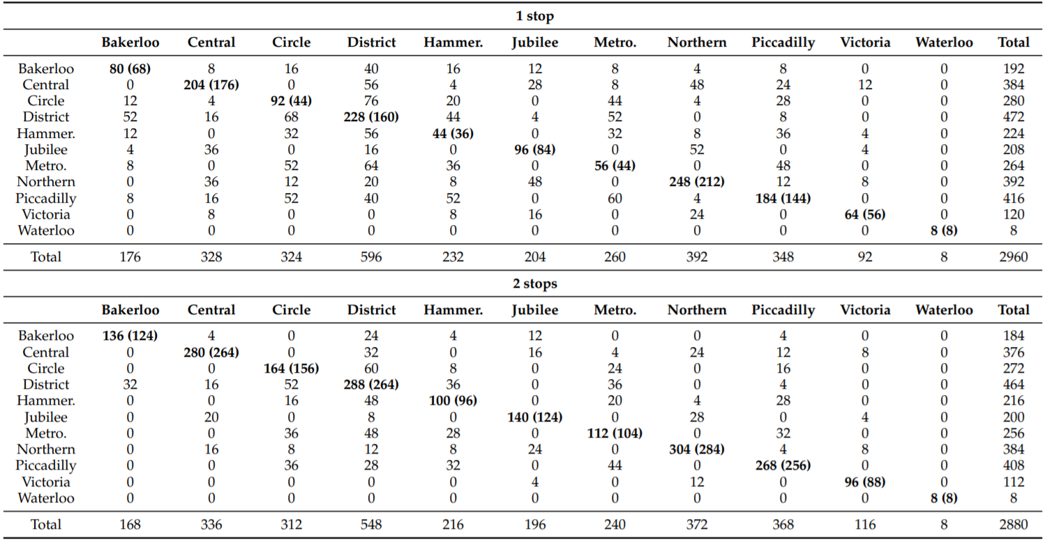
The confusion matrix below compares the system's predictions (rows) with the true classes (columns). Bold values on the diagonal indicate correct line classifications; the values in brackets indicate correct station estimates.
Publications
For further details, see the publications below.1) Nguyen, Khuong An, You Wang, Guang Li, Zhiyuan Luo, and Chris Watkins. "Realtime Tracking of Passengers on the London Underground Transport by Matching Smartphone Accelerometer Footprints." Sensors 19, no. 19 (2019): 4184.
2) Nguyen, Khuong An, Chris Watkins, and Zhiyuan Luo. "Co-location epidemic tracking on London public transports using low power mobile magnetometer." In 2017 International Conference on Indoor Positioning and Indoor Navigation (IPIN), pp. 1-8. IEEE, 2017.
3) Nguyen, Khuong An, Raja Naeem Akram, Konstantinos Markantonakis, Zhiyuan Luo, and Chris Watkins. "Location Tracking Using Smartphone Accelerometer and Magnetometer Traces." In Proceedings of the 14th International Conference on Availability, Reliability and Security (ARES), pp. 1-9. 2019.